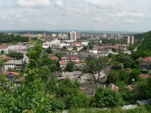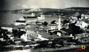
Kyustendil (Bulgarian: Кюстендил) is a town in the far west of Bulgaria, the capital of the Kyustendil Province, a former bishopric and present Latin Catholic titular see.


The town is situated in the southern part of the Kyustendil Valley, near the borders of Serbia and North Macedonia; 90 km southwest of Sofia, 130 km northeast of Skopje and 243 km north of Thessaloniki. The population is 44,532, with a Bulgarian majority and a Roma minority. During the Iron Age, a Thracian settlement was located within the town, later known as Roman in the 1st century AD. In the Middle Ages, the town switched hands between the Byzantine Empire, Bulgaria and Serbia, prior to Ottoman annexation in 1395. After centuries of Ottoman rule, the town became part of an independent Bulgarian state in 1878.
Geography
Kyustendil is a national balneological resort at an altitude of 600 metres. There are more than 40 mineral springs in the town. The waters have a high content of sulfite compounds. These are used for the treatment of the locomotory system, gynecological and other kinds of diseases. The resort region includes several baths, balneological complexes and others.
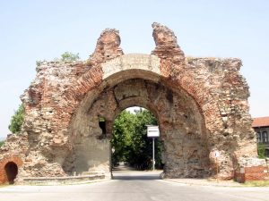
Kyustendil is located at the foot of the Osogovo mountain, on both banks of the Banshtica River and is a well-known centre of balneology and fruit growing. The town is 90 kilometres southwest of Sofia, 69 km northwest of Blagoevgrad and 22 km from the border with North Macedonia and Serbia. The fortress was built by the Romans. Thermae, basilicas, floor mosaics have been uncovered.
map:
source: en.wikipedia.org