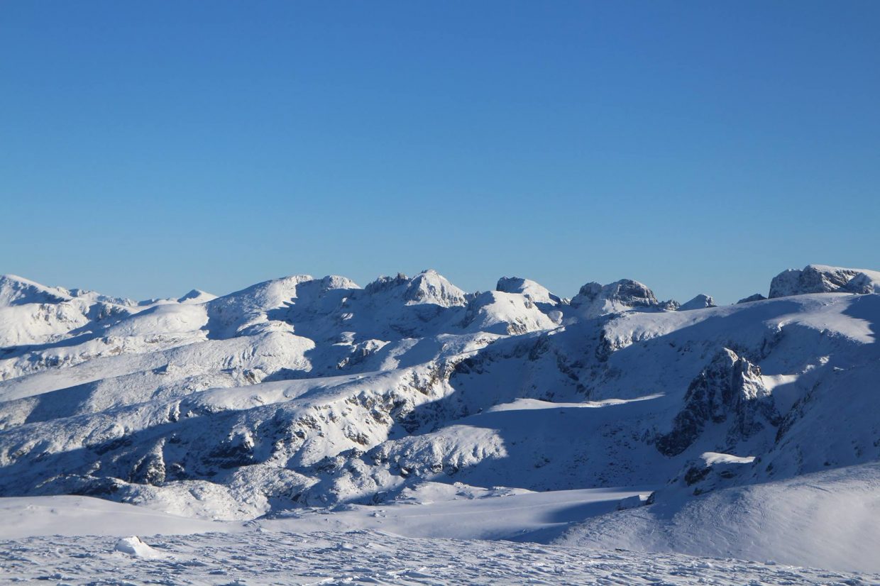
Rila (Bulgarian: Рила, pronounced [ˈriɫɐ]) is the highest mountain range of Bulgaria and the Balkan Peninsula. It is situated in southwestern Bulgaria and forms part of the Rila–Rhodope Massif. The highest summit is Musala at an altitude of 2,925 m which makes Rila the sixth highest mountain range in Europe after the Caucasus, the Alps, Sierra Nevada, the Pyrenees and Mount Etna, and the highest one between the Alps and the Caucasus. It spans a territory of 2,629 km2 with an average altitude of 1487 m. The mountain is believed to have been named after the river of the same name, which comes from the Old Bulgarian verb “рыти” meaning “to grub”.


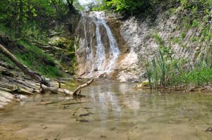
Rila has abundant water resources. Some of the Balkans’ longest and deepest rivers originate from Rila, including the Maritsa, Iskar and Mesta rivers. Bulgaria’s main water divide separating the Black Sea and the Aegean Sea drainage systems follows the main ridge of Rila. The mountain range is dotted with almost 200 glacial lakes such as the renowned Seven Rila Lakes, and is rich in hot springs in the fault areas at the foothills, including the hottest spring in South-eastern Europe in Sapareva Banya.
The mountain range has varied flora and fauna with a number of endemic and relict species and some of the best preserved forests in the country. The biodiversity and the pristine landscapes are protected by Rila National Park which covers much of the mountain; the rest lies within Rila Monastery Nature Park. In addition, there are five nature reserves: Parangalitsa, Central Rila Reserve, Rila Monastery Forest, Ibar and Skakavitsa.
The most recognisable landmark of the mountain range is the Rila Monastery, Bulgaria’s largest and most important monastery, founded in the 10th century by Saint John of Rila. Due to its outstanding cultural and spiritual value it was declared a UNESCO World Heritage Site in 1983. Rila is also a popular destination for hiking, winter sports and spa tourism, hosting the nation’s oldest ski resort Borovets, as well as numerous hiking trails. Some of the most important hydro power stations in Bulgaria are situated in the eastern part of the mountain range.
There are two summits above 2,900 m, Musala and Malka Musala. Some of the highest peaks are:
a summit in Rila, The summit of Malyovitsa
Musala, 2,925 metres (9,596 ft)
Malka Musala, 2,902 metres (9,521 ft)
Irechek, 2,852 metres (9,357 ft)
Bezimenen (Noname), 2,792 metres (9,160 ft), between Musala and Aleko
Deno, 2,790 metres (9,154 ft)
Studenia Chal, 2,785 metres (9,137 ft)
Golyam Bliznak, 2,779 metres (9,117 ft)[16]
Malak Bliznak, 2,777 metres (9,111 ft)[17]
Mancho, 2,771 metres (9,091 ft)[18]
Pesokliva Vapa, 2,769 metres (9,085 ft)[19]
Ovcharets (Yurushki Chal), 2,768 metres (9,081 ft)
Marishki Chal, 2,765 metres (9,072 ft)[20]
Golyam Kupen, 2,731 metres (8,960 ft)
Malyovitsa, 2,729 metres (8,953 ft)
Cherna Polyana, 2,716 metres (8,911 ft)[12]
Aleko, 2,713 metres (8,901 ft)
Rilets, 2,713 metres (8,901 ft)
Golyam Skakavets, 2,705 metres (8,875 ft)
Popova Kapa, 2,704 metres (8,871 ft)
Lopushki Vrah, 2,698 metres (8,852 ft)
Otovishki Vrah, 2,696 metres (8,845 ft)
Yosifitsa, 2,696 metres (8,845 ft)
Lovnitsa, 2,695 metres (8,842 ft)
Kanarata, 2,691 metres (8,829 ft)
Pogledets, 2,690 metres (8,825 ft)
Draganitsa, 2,690 metres (8,825 ft)
Orlovets, 2,685 metres (8,809 ft)
Aladzha (Pastri) Slap, 2,684 metres (8,806 ft)
Vodni Chal, 2,683 metres (8,802 ft)
Malak Skakavets, 2,682 metres (8,799 ft)
Zlia Zab, 2,678 metres (8,786 ft)
Skalets (Redjepitsa) 2,678 metres (8,786 ft)
Teodosievi Karauli, 2,671 metres (8,763 ft)
Damga (Vazov Vrah), 2,669 metres (8,757 ft)
Shishkovitsa, 2,669 metres (8,757 ft)[21]
Golyam Kalin, 2,668 metres (8,753 ft)
Pavlev Vrah, 2,667 metres (8,750 ft)
Ibar, 2,666 metres (8,747 ft)
Skalitsa (Seymenski kamak), 2,666 metres (8,747 ft)
Malak Kalin, 2,664 metres (8,740 ft)
Dodov Vrah, 2,661 metres (8,730 ft)
Eleni Vrah, 2,654 metres (8,707 ft)
Angelov Vrah, 2,643 metres (8,671 ft)
Draganitsa, 2,642 metres (8,668 ft)
Ostrets (Sivrichal), 2,641 metres (8,665 ft)
Suha Vapa, 2,638 metres (8,655 ft)
Ravni Chal, 2,637 metres (8,652 ft)
Kovach Vrah, 2,634 metres (8,642 ft)
Zavrachitsa, 2,633 metres (8,638 ft)
Belmeken, 2,626 metres (8,615 ft)
Kamilata, 2,621 metres (8,599 ft)
Golyam Mechi Vrah, 2,617 metres (8,586 ft)
Golyam Polich, 2,615 metres (8,579 ft)
Kyoravitsa (Ostrets), 2,612 metres (8,570 ft)
Baba, 2,609 metres (8,560 ft)
Golyama Pastritsa (Uzunitsa), 2,606 metres (8,550 ft)
Dvuglav, 2,605 metres (8,547 ft)
Golyam Mramorets (Golyam Mermer), 2,602 metres (8,537 ft)
Venetsa, 2,600 metres (8,530 ft)
Haramiyata (Hayduta), 2,465 metres (8,087 ft)
map:
source: en.wikipedia.org